 Every Saturday I get a call from some group or other of Carp anglers travelling out for a fishing holiday to one of our venues who has got lost or is struggling to find their way to the lake in question. It is totally understandable that navigating in a foreign country can cause a few problems, especially if it is your first time in France. The major issue of driving on the right is in itself cause for a few problems, so add to this different placings for road signs, signposts in French etc. I touched on the subject in a recent post on avoiding an awful trip Carp Fishing. So the here then is my method of avoiding getting “Lost in France!”
Planning your Trip:
First off plan your trip. We give out instructions that are quite detailed but are not a substitute for you doing your homework.
Get a Good Map:
Get on the net, get a decent map and find out exactly where you are going. Note the main towns on your route, and the direction you’l need to take at all the major intersections.
Use the Internet:
Sites like “Via Michelin” or “Mappy.co.uk” will help you calculate your journey time and the amounts for tolls and fuel. If you have any doubt about the directions, look into this before you go. We are on hand on the weekend though to help give assistance, but if you don’t have a map and get totally lost there is little we can do to help for the other side of the country or from the UK.
Introducing Google Earth:
I can’t recommend Google Earth highly enough, for planning your journey. It gives you pretty clear satellite photos of the major part of France, and it is fairly easy to find your chosen venue. Add to this the fact we give out the Longitude and Latitude coordinates and you can see that is can be an extremely useful tool when combined with the other route planners, multimaps and sat navs we have available today.
There are a number of ways of finding your destination on Google Earth, once we have sent out the directions. The simplest is to key in the coordinates and the programme just zooms in to the location.
Otherwise you can type in the name of the village and the country and again this will get you pretty close. If the lake has a full postal address this again is taken into account by Google Earth and will show you its location.
Another useful part of this programme is you can measure the venue to see the distance to island for example or the number of miles to the nearest village.
GPS :
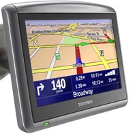
I’ve mentioned these a number of times in recent posts but I’m totally sold on these postable Sat Nav GPS units. As I’ve said before I use the Tomtom One, but any of the modern hand held units will do the job. (Others include Garmin, Navman, Via Michelin etc).
On the Tomtom system I have I’ve found the individual country maps to be more detailed than the general Map of Europe so for the £39 it costs it might be worth it.
Since getting a sat nav I must admit I have hardly used my atlas. They do though require a certain amount of time spending on them to learn your way around the functions.
My favourite method is to use them in conjunction with Google Earth. I get the coordinates from the net and type them into the GPS. This then, gives you a detailed view of the area, by sliding the cursor up to enlarge the page. Often you can see the lake you are going to represented on the map.
I generally keep it on the default setting of ‘Fastest route’ via ‘Toll roads’.
One word here, it is far better to simply follow the sat nav even if you have someone reading a map. While the route may occasionally be a bit round the houses it always gets you there. Bear in mind though that they are not infallible and do on occasions get things wrong, especially if road systems have been changed. They were after all programmed by some guys who almost certainly had never seen the route in question. The strangest instance I’ve had to date was when it tried to send me across a bridge that didn’t exist. The footings were there and the pillars on the edge of the major thoroughfare it was meant to be crossing. They had simply not built the bridge… When I tried to turn on to it there were at least three cars behind me all with GPS units on the windscreen.
Don’t Go by the Postcode in France:
In the UK it is really useful to be able to key in the post code and get to the address you want. This doesn’t work in France. A usual French post code will be eg: 53200 and covers a number of villages.
Maps, Atlas’:
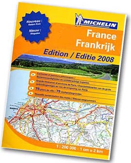
All this electronic wizardry doesn’t mean you can forgo a good map. We recommend the Michelin Maps, but do get a sufficiently detailed one. As the Ordinance Surveys in the UK the Michelins come in various scales.
The one that covers the whole of France is likely to be too large a scale to have the small villages where many of our venues are located. I suggest the Michelin Road Atlas; this is pretty detailed and is relatively compact.
So there you go, plan your trip, make use of the modern navigation devices both in your car and on the internet. If you take your time to plan your trip carefully you’ll not end up ‘Lost in France’


Comments